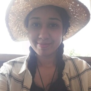
Neha Joshi
Cranfield University
Project
Earth observation for sustainable sugarcane production
Supervisors
- Dr Daniel Simms
- Dr Paul Burgess
PhD Summary
The project I am undertaking investigates how sugarcane can be mapped and monitor from long-term satellite programmes and new satellite constellations in near-real time. It also explores how the emergence of cloud-based technologies and enabling techniques for analysing large quantities of EO data, can be used to measure and map sugarcane over wide geographical areas at high resolutions. The end goal of this project is to deliver a robust tool for the monitoring of sugarcane that will lead to greater understanding of the changing spatial and temporal patterns in cultivation and yield. To do this, an extensive sugarcane dataset will be built from long-term EO programmes, new satellite constellations, databases and field level expertise provided by Neta Analytics (a commercial company who work with the Indian Sugarcane sector to develop tools for data-driven decision making) and available Indian land records. These datasets will then be used to test new machine learning methods for the detection of sugarcane and the retrieval of biophysical parameters linked to crop development, yield development and stress (water, pests, and disease). The outcome of the EO of sugarcane will be a compressive database of crop performance indicators linked with field level management data from Neta’s Indian sugarcane processors. This is will enable the development and evaluation of a scenario-based sugarcane decision support tool, incorporating yield models based on EO, weather, soil, and cane variety.
Previous activity
After completing my BSc in Geography at the University of Leicester, I continued to study at the same University to complete my MSc in Geographical Information Science.
Why did you choose doctoral research?
During my MSc studies I learnt how remote sensing and the use of satellite images is playing an increasingly important role within society and is rapidly evolving in areas such as business, marketing, and the environment with forecasting, modelling and many more applications. There is pretty much a sensor to detect anything therefore after developing an understanding of how remotely sensed data can be used to tackle worldwide problems and realising their importance, I decided to apply for a Doctoral Research project that applies the use of Earth Observation datasets to tackle sustainability problem.
Why did you choose CENTA?
This CENTA studentship interested me not only because it provided me with the chance to undertake my ideal PhD project (a satellite-based project within Earth observation sciences) but also because the advanced training it offers enables PhD students to develop not only academically but personally and professionally, whilst networking with other doctoral researchers and academics from different disciplines and institutions.
Future plans
I hope that carrying out this PhD research will help me to pursue a career in academia or industry. But wherever my career journey takes me, the opportunities provided by the University and CENTA will provide me transferable skills that will benefit me in many career areas.
