Project highlights
- Develop new algorithm approaches to transform thermal satellite remote sensing for crop monitoring
- Confront the challenge of big data to explore changes in the temperature and composition of the Earth’s surface
- Opportunity to work on design and development of upcoming European operational satellite mission with world leading industry in space/aeronautics and data economy
Overview
Food security has always been a major strategic issue related to the global economic development, social stability and national independence. The agricultural sectors in countries such as China and India are vast in terms of scale and production, operating across different climate zones serving heterogeneous population distributions. There are many challenges as population increases; with a need to secure the food supplies that underpin sustainable economic growth and jobs for workers in rural employment sectors, and a need for robust environmental management of soil and water resources. Sitting around all of these issues is the contribution that changes to the climate may have on crop stress and yield and market models in the sector.
Ongoing research in NCEO-Leicester is utilising land surface temperature (LST) data for crop monitoring effort with a focus on routes to impact by the generation of informative indices. Current operational infrared satellite EO sensors typically offer highly accurate LST but their spatial resolutions are of order 1 km. Some higher spatial thermal imaging capability for LST measurement is available but their limited temporal sampling and lower accuracy restricts scientific advances and uptake of applications from these missions. In particular, accurate measurement of LST at local (< 100 m) scales to resolve fields and knowledge of the composition of the Earth’s surface is lacking.
The cumulative research work of the Land Surface Temperature Group in NCEO-Leicester over a decade has been central to the European Space Agency (ESA) being able to define and implement Europe’s first, high spatial resolution, thermal infra-red mission. This mission, the Copernicus Land Surface Temperature Monitoring (LSTM) is built primarily to deliver operational agricultural services. The challenge is to develop robust approaches to truly exploit the advantages of these higher resolution missions for field-scale crop monitoring.
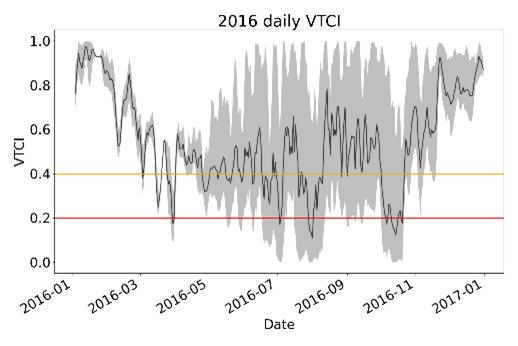
Figure 1: Daily Vegetation Temperature Condition Index (VTCI) produced by the NCEO-Leicester Surface Temperature Group for 2016 over the Heteo Plain, China.
Host
National Centre for Earth ObservationTheme
- Climate and Environmental Sustainability
Supervisors
Project investigator
Dr Darren Ghent, NCEO Leicester, [email protected]
Co-investigators
Prof John Remedios, NCEO Leicester, [email protected]
How to apply
- Each host has a slightly different application process.
Find out how to apply for this studentship. - All applications must include the CENTA application form. Choose your application route
Methodology
This project will develop new methods to study the changing temperature of the Earth’s surface at the field scale, a need recognised to be very important by international space agencies and environmental scientists. This project will apply new mathematical approaches – optimal estimation (OE) and artificial intelligence (AI) – to retrieve LST from remote sensing platforms, and to combine with optical information, such as normalised difference vegetation indices (NDVI), to generate crop monitoring indices that can improve the interpretation of the crop conditions.
AI techniques, such as Machine Learning and neural networks have been successfully applied for big data analysis in many areas of science. Such methods have the potential to transform thermal satellite remote sensing. This project will develop a new AI method to data from current missions and new sensors, such as for LSTM, and will carry out testing of the methods on both simulations and real data from hyperspectral aircraft measurements. Once verified, the new scheme will be used to identify the performances, modelling and design of new satellite sensors.
Training and skills
Students will be awarded CENTA2 Training Credits (CTCs) for participation in CENTA2-provided and ‘free choice’ external training. One CTC equates to 1⁄2 day session and students must accrue 100 CTCs across the three years of their PhD.
In the first year, students will be trained on environmental data science, research methods and core skills. Throughout the PhD, training will progress from core skills sets to master classes specific to this project’s themes. Specialist training will include sensor techniques, radiative transfer for infra-red and microwave, non-linear data methods and general remote sensing. The National Centre for Earth Observation will provide access to its Researcher Forum, staff conferences/workshops and national-level training. There is good access to international summer schools, and the student can gain experience from attending European Space Agency meetings and events.
Partners and collaboration
This project will fall within the National Centre of Earth Observation (NCEO), which is the leading collective of satellite remote sensing in the UK. Furthermore, the project will feed directly into the preparations for a future high resolution thermal sensor, through the European Space Agency (ESA). The student will have a unique opportunity to work alongside the leading scientists across Europe and beyond in measuring the temperature of the Earth from space, and preparing for the upcoming Copernicus Land Surface Temperature Mission (LSTM). Specific collaborations on developing the methods with leading academic centres and world leading space industries.
Further details
Further details on how to contact the supervisor for this project and how to apply for this project can be found here:
For any enquiries related to this project please contact Dr Darren Ghent, [email protected].
The successful applicant would be registered as a student at the University of Leicester.
To apply to this project:
- You must include a CENTA studentship application form, downloadable from: CENTA Studentship Application Form 2024.
- You must include a CV with the names of at least two referees (preferably three) who can comment on your academic abilities.
- Please submit your application and complete the host institution application process via: https://le.ac.uk/study/research-degrees/funded-opportunities/centa-phd-studentships. Please scroll to the bottom of the page and click on the “Apply for NERC CENTA Studentship” button. Your CV can uploaded to the Experience section of the online form, the CENTA application form 2024 can be uploaded to the Personal Statement section of the online form. Please quote CENTA 2024-L17-CENTA2-PHYS1-GHEN when completing the application form.
Applications must be submitted by 23:59 GMT on Wednesday 10th January 2024.
Dr Darren Ghent is the lead scientist on the international Climate Change Initiative LST Project, and leads the LST activities for the operational Sentinel-3 satellite mission and the upcoming LSTM mission. The student will have a chance to be part of a national EO community complementing the environmental science focus of CENTA. Professor Remedios is Director of NCEO and Professor at University of Leicester. NCEO is a national centre funded by NERC and distributed across key Earth Observation (EO) groups at Universities and research laboratories.
Possible timeline
Year 1
Training in software usage and development, and attendance at dedicated workshops. Initial evaluation of high resolution IR data and data analysis to produce a first high resolution LST dataset.
Year 2
Determination of robust relationships and construction of combined LST & Land Surface Emissivity retrieval algorithms and field-scale crop indices. Conference attendance, preparation of manuscript for journal submission. Continued development of thesis chapters.
Year 3
Advanced method for high resolution LST capable of identifying the performances, modelling and design of new satellite sensors for crop monitoring. Manuscript submission and revision, International conference attendance, thesis preparation.
Further reading
Ghent, D., Corlett, G., Goettsche, F., & Remedios, J. (2017) Global land surface temperature from the Along-Track Scanning Radiometers. Journal of Geophysical Research – Atmospheres, 122, 12167-12193
Ghent, D., Veal, K., Trent, T., Dodd, E., Sembhi, H., and Remedios, J. (2019). A New Approach to Defining Uncertainties for MODIS Land Surface Temperature. Remote Sensing, 11, 1021
Hulley, G., Veraverbeke, S., and Hook, S., Thermal-based techniques for land cover change detection using a new dynamic MODIS multispectral emissivity product (MOD21), (2014). Remote Sensing of Environment, 140, 755-765, doi:10.1016/j.rse.2013.10.014.
Perry, M. J. S. (2017). High Spatial Resolution Retrieval of LST and LSE for the Urban Environment (Doctoral dissertation, Department of Physics and Astronomy). https://leicester.figshare.com/articles/thesis/High_Spatial_Resolution_Retrieval_of_LST_and_LSE_for_the_Urban_Environment/10231151
BBC News (2022) ‘UK also broke its land surface temperature record’. Available at: https://www.bbc.co.uk/news/science-environment-62257163